

i
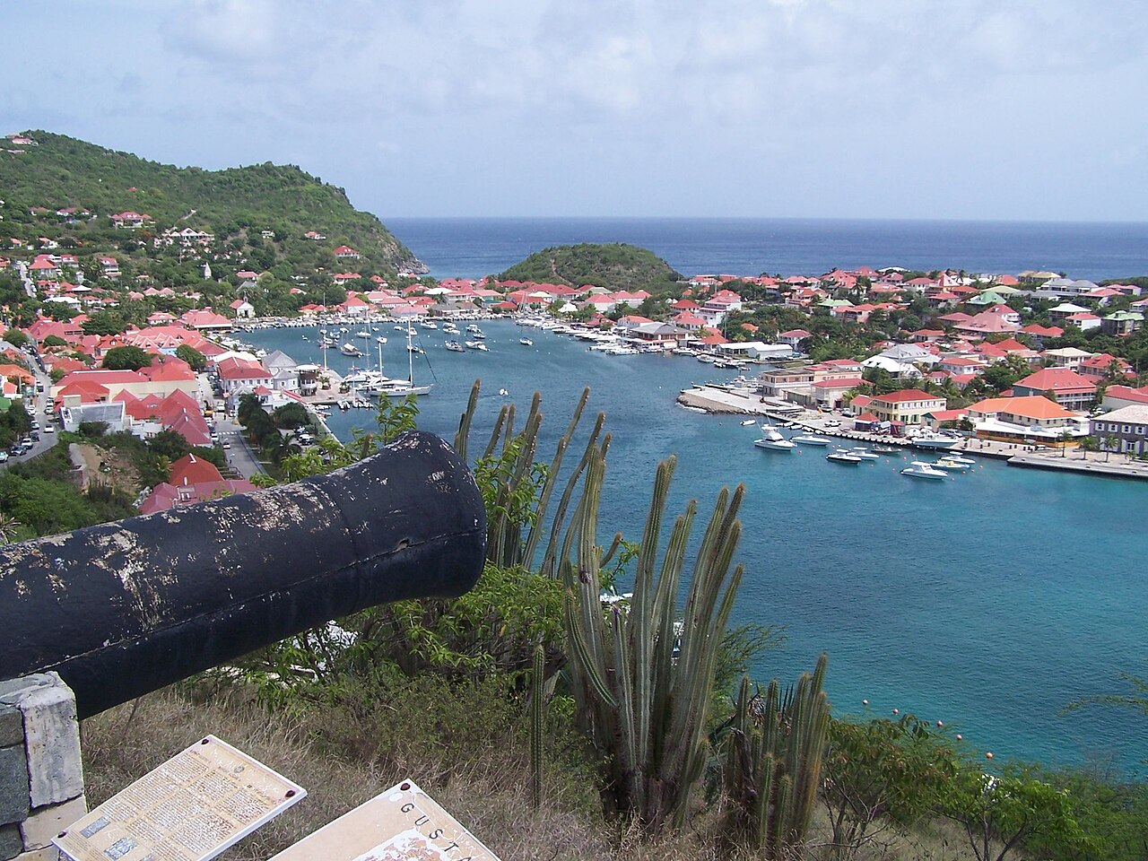
Photo by Kevin Gabbert, Public domain, via Wikimedia Commons.
Best time to visit Saint Barthélemy
Saint Barthélemy · The Caribbean
All twelve months scored on daily temperature, rainfall, humidity and holiday crowding.
The year in Saint Barthélemy
Tap a month for its page
- JanJSaint Barthélemy in January: good, busy
- FebFSaint Barthélemy in February: good, busy
- MarMSaint Barthélemy in March: good
- AprASaint Barthélemy in April: sweet spot
- MayMSaint Barthélemy in May: sweet spot
- JunJSaint Barthélemy in June: sweet spot
- JulJSaint Barthélemy in July: sweet spot
- AugASaint Barthélemy in August: sweet spot
- SepSSaint Barthélemy in September: sweet spot
- OctOSaint Barthélemy in October: good
- NovNSaint Barthélemy in November: sweet spot
- DecDSaint Barthélemy in December: good, busy
- Sweet spot
- Good
- OK
- Avoid
- Busy
Dry season: Nov–Aug, 6 or fewer rainy days a month.
Plan this trip
Each site opens on its own search: choose your dates there. A few open on their home page, where you type the place too.
Links marked Ad pay us a commission if you book, at no extra cost to you; most pay nothing, and what a site pays never decides whether it is listed or where. How we rank
Flights from
Flights
Your city is a guess from your time zone. Choose your city
Where are you flying from? Choose your city for its flights and fares.
Book with the airline
Where to stay
Book direct
Luxury
Things to do
Car hire
Rent direct
Travel insurance
Check whether your bank card or home insurance already covers this trip.
If the trip needs a visa, the travel agent or visa centre usually sells the cover it asks for.
Mobile data (eSIM)
Your own plan's EU roaming may already cover this.
Renting a pocket Wi-Fi is the other common way to stay connected.
These are sites people in book with. Each opens in a new tab, on the site's own pages.
Things to do in Saint Barthélemy
- Church of Our Lady of the Assumption, Gustavia Church located in Saint-Barthélemy, in France
- Cove Bay Costal bay in Saba, the Caribbean Netherlands
- Mary Star of the Sea Church, Grand Case Church located in Saint-Martin, in France
- Mary Star of the Sea Church Church in Simpson Bay, Sint Maarten, Kingdom of the Netherlands
- Morne du Vitet Mountain in France
- Golden Rock (archaeological site) Caribbean archeological site
- St. Gerard Church, The Valley Church in Anguilla, United Kingdom
Tours and tickets in Saint Barthélemy
Each site opens on its own search: choose your dates there. A few open on their home page, where you type the place too. Links marked Ad pay us a commission if you book, at no extra cost to you; most pay nothing, and what a site pays never decides whether it is listed or where. How we rank
Sights and their lines from Wikivoyage, licensed CC BY-SA 4.0, and Wikidata; in order of how often each one's Wikipedia article was read on phones in the last 12 months.
Month by month
No fare history for this route yet, so this ranking is climate and crowds only — the price column will fill in as the scanner collects.
| Month | Max °C | Rain days | Humidity | Sun h/day | Verdict | Why |
|---|---|---|---|---|---|---|
| Jan | 26° | 1d | 74% | 10.8h | goodbusy | busier than usual |
| Feb | 26° | 2d | 74% | 10.8h | goodbusy | busier than usual |
| Mar | 26° | 0d | 74% | 11.4h | good | 26C max, 0 rainy days |
| Apr | 26° | 3d | 75% | 11.6h | sweet spot | 26C max, 3 rainy days |
| May | 27° | 2d | 77% | 11.6h | sweet spot | 27C max, 2 rainy days |
| Jun | 28° | 2d | 78% | 11.8h | sweet spot | 28C max, 2 rainy days |
| Jul | 28° | 3d | 78% | 11.8h | sweet spot | 28C max, 3 rainy days |
| Aug | 29° | 4d | 78% | 11.5h | sweet spot | 29C max, 4 rainy days |
| Sep | 29° | 6d | 78% | 11.0h | sweet spot | 29C max, 6 rainy days |
| Oct | 29° | 7d | 77% | 10.5h | good | 29C max, 7 rainy days |
| Nov | 28° | 6d | 76% | 10.2h | sweet spot | 28C max, 6 rainy days |
| Dec | 27° | 2d | 74% | 10.4h | goodbusy | busier than usual |
Rain days are the days with at least 1 mm of rain, as a weather station counts them.
Weather read at Gustavia: ten years of ERA5 and ERA5-Land reanalysis, through Open-Meteo's open data.
A busy month is a crowded one, not a bad one — usually it is crowded because the weather is good. It is flagged rather than scored down, and crowds alone never make a month “avoid”: that is reserved for weather worth skipping.
How busy it gets
Then and now
Saint Barthélemy's October days now average 28.5°C, 1.4°C warmer than in 1981–1990. 12 of 12 months are clearly warmer.
| Jan | Feb | Mar | Apr | May | Jun | Jul | Aug | Sep | Oct | Nov | Dec | |
|---|---|---|---|---|---|---|---|---|---|---|---|---|
| 1981–90 | 25.1° | 24.8° | 24.8° | 25.4° | 26.3° | 27.0° | 27.3° | 27.5° | 27.6° | 27.2° | 26.5° | 25.6° |
| 2017–26 | 26.2° | 25.9° | 25.9° | 26.3° | 27.1° | 27.9° | 28.3° | 28.6° | 28.8° | 28.5° | 27.8° | 26.9° |
| Change | +1.1° | +1.1° | +1.0° | +0.9° | +0.8° | +0.9° | +0.9° | +1.1° | +1.3° | +1.4° | +1.3° | +1.3° |
The average daily high, month by month, for the nearest ERA5 grid cell. Bold is a clear change; grey is within the ordinary spread between years. Every destination, ranked.
Getting there
Fly into Sint Maarten (SXM), then drive. The flights under Where to book are to Sint Maarten.
| Sint Maarten (SXM) | the drive is not measured yet |
|---|---|
| Gustavia (SBH) | the drive is not measured yet |
The drive from each airport is the road's, from openrouteservice.org by HeiGIT: typical, not a schedule.
How far Saint Barthélemy is, and what it costs, depends on where you set off from — the months above do not.
- from Bogota
- from Miami
- from New York
- from Boston
- from Toronto
- from Chicago
- from Lima
- from Mexico City
Open in Rome2rio for every way from to Saint Barthélemy, flying or not.
Before you go
| Currency | Euro |
|---|---|
| Languages | French |
| Driving | On the right |
| Calling code | +590 |
| Travel advice | No advice against travel — UK Foreign Office, updated 2025-12-10 Exercise normal security precautions — Global Affairs Canada, updated 2026-09-24 Level 1: Exercise Normal Precautions — US State Department, updated 2026-08-20 |
| Health | UK Foreign Office health advice |
Facts from Wikidata (CC0), the UK Foreign Office (Open Government Licence) and the World Bank, refreshed 2026-10-08. The advisory is written for British travellers; entry rules depend on your passport.Travel advice for American readers is the US State Department's (public domain), and for Canadian readers Global Affairs Canada's (Open Government Licence - Canada), each in its own words and written for its own citizens; entry rules depend on your passport.
Being there
On arrival
- Paying — The currency is the euro, and the island had 14 cash machines at the end of 2025.
- UPI, for visitors from India — Not accepted for paying here; bring a card that works abroad.
- Tipping — Most restaurants in Gustavia add a service charge of 10 to 15%.
Getting around Saint Barthélemy
There are no long-haul flights: most visitors change at Sint Maarten (SXM), or in Guadeloupe, Antigua or Puerto Rico, for a short flight to Rémy de Haenen airport, which closes 15 minutes after sunset, and ferries sail from Sint Maarten and Saint-Martin to Gustavia several times a day, in under an hour. At Princess Juliana Airport, a representative of the ferry company meets passengers and takes them to the marina (for Great Bay Express, a 20 to 25 minute shuttle ride to Philipsburg). There is no public transport on the island: most visitors hire a car, from agencies at the airport and in Gustavia, best booked ahead in high season.
- Apps — Maps: Google Maps, Apple Maps. There are two taxi stands, which you can call: at the airport on +590 690 52 40 40, and at the ferry dock in Gustavia on +590 690 27 66 31.
St Barts is a small island and everything is within a half-hour drive. Rent a small 4x4 Jeep but be careful! More on Wikivoyage
From the Wikivoyage article on Saint-Barthélemy, written by travellers and licensed CC BY-SA 4.0.
Help
- Emergency — 112 (any emergency) · police 17 · ambulance 15 · fire 18.
TravelCharika is not an emergency service: we cannot call for help or send anyone. Numbers can change; if one fails, ask someone local or your hotel.
- Hospitals near Saint Barthélemya search on Google Maps
- Pharmacies near Saint Barthélemya search on Google Maps
Your embassy — : how to reach your embassy or consulate abroad. A guess from your city, : a city is not a passport.
Put together by hand from the sources listed, checked 8 October 2026. Apps, cards and rules change, so check before you rely on one.
Sources (10)
- gov.uk/foreign-travel-advice/st-martin-and-st-barthelemy/getting-help
- travel.gc.ca/destinations/saint-barthelemy
- saintbarth-tourisme.com/travel
- greatbayexpress.com/shuttle
- iedom.fr/IMG/pdf/ra_iedom_2025_ed._2026_-_saint-barthelemy.pdf
- en.wikivoyage.org/wiki/Gustavia
- developers.google.com/maps/coverage
- apple.com/ios/feature-availability
- pib.gov.in/PressReleasePage.aspx?PRID=2286608
- rbidocs.rbi.org.in/rdocs/AnnualReport/PDFs/09PAYMENT290526C6588B796E664822A2BD0DEB6452CAD4.PDF
Saint Barthélemy in pictures
i
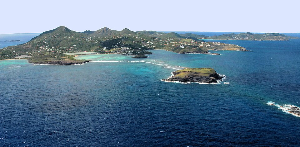
Starus, CC BY-SA 3.0, via Wikimedia Commons
What Saint Barthélemy is like
Saint-Barthélemy is a French island in the Caribbean among the Leeward Islands. St Barts has long been considered a playground of the rich and famous and is known for its beautiful pristine beaches, gourmet dining in chic restaurants and high-end designer shopping. More on Wikivoyage
- Worth seeing
- The capital city of Gustavia - It is known for its picturesque harbour, full of sailboats and super-yachts. You will also find high-fashion stores, jewelry stores, bars, and restaurants. More on Wikivoyage
- Worth doing
- St Barts weddings - To get married on St. Barts, one of the couple has to have been resident on the island for a month. More on Wikivoyage
- Getting in
- The flights into St Barts are by small planes ideally adapted to the short runway. The airport is truly one of the most wonderful aviation experiences. More on Wikivoyage
- Staying safe
- St Barths is without a doubt the safest island in the Caribbean, and one of the safest places in the world. There is virtually zero crime, beyond petty theft. More on Wikivoyage
From the Wikivoyage article on Saint-Barthélemy, written by travellers and licensed CC BY-SA 4.0; the full article has far more. The numbers above are measured; this is experience.
Around Saint Barthélemy
Nearby
- Saint Martin / Sint Maarten Sint Maarten · 25 km
- Anguilla Anguilla · 42 km
- Saint Kitts and Nevis Saint Kitts and Nevis · 68 km
- Antigua and Barbuda Antigua and Barbuda · 137 km
Kind of place
Saint Barthélemy is in Saint Barthélemy, The Caribbean. Distances are great-circle, so a short one can still be a long way round.
Check your inbox. A confirmation is on its way: open the link in it, press Confirm, and you are subscribed.
That did not go through. Check the address, or try again in a minute.
Already sent. A confirmation went to that address in the last day: look for it, spam folder included. Its link works for three days.
You are not on the list until you confirm from your inbox. The list lives with our email provider, Resend; the privacy page says the rest.
Links marked Ad pay us a commission if you book through one, at no extra cost to you. That does not affect the scores on this page, which are computed from climate and fare data before any link is built.