

i
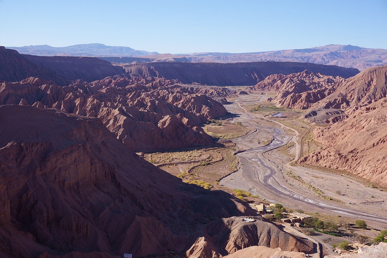
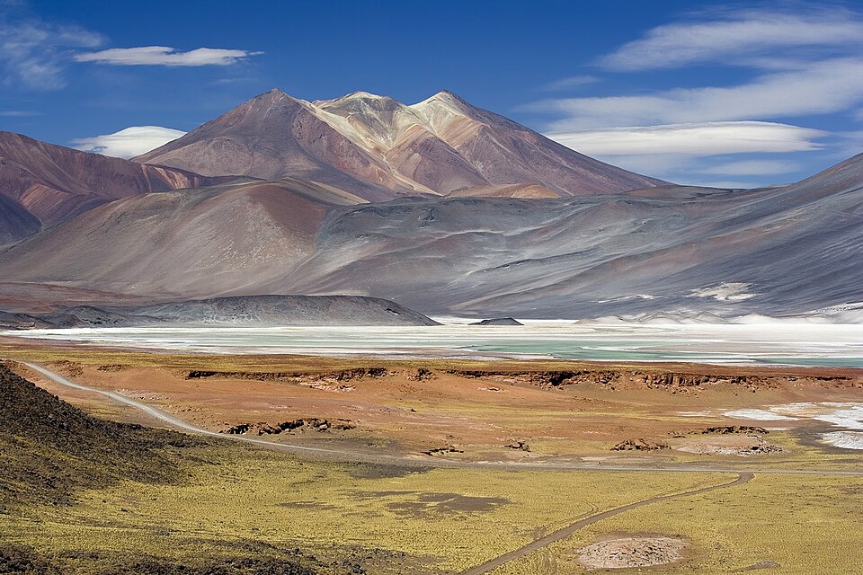
Photo by kallerna, CC BY-SA 4.0, via Wikimedia Commons.
Best time to visit San Pedro de Atacama
Chile · Latin America
All twelve months scored on daily temperature, rainfall, humidity and holiday crowding.
The year in San Pedro de Atacama
Tap a month for its page
- JanJSan Pedro de Atacama in January: good, busy
- FebFSan Pedro de Atacama in February: sweet spot
- MarMSan Pedro de Atacama in March: good, busy
- AprASan Pedro de Atacama in April: sweet spot
- MayMSan Pedro de Atacama in May: sweet spot
- JunJSan Pedro de Atacama in June: sweet spot
- JulJSan Pedro de Atacama in July: sweet spot
- AugASan Pedro de Atacama in August: sweet spot
- SepSSan Pedro de Atacama in September: good
- OctOSan Pedro de Atacama in October: good, busy
- NovNSan Pedro de Atacama in November: good, busy
- DecDSan Pedro de Atacama in December: good, busy
- Sweet spot
- Good
- OK
- Avoid
- Busy
Dry all year: 6 or fewer rainy days in every month.
Plan this trip
Each site opens on its own search: choose your dates there. A few open on their home page, where you type the place too.
Links marked Ad pay us a commission if you book, at no extra cost to you; most pay nothing, and what a site pays never decides whether it is listed or where. How we rank
Flights from
Flights
Your city is a guess from your time zone. Choose your city
Where are you flying from? Choose your city for its flights and fares.
Book with the airline
Where to stay
Book direct
Luxury
Things to do
Car hire
Travel insurance
Check whether your bank card or home insurance already covers this trip.
If the trip needs a visa, the travel agent or visa centre usually sells the cover it asks for.
Mobile data (eSIM)
Your own plan's EU roaming may already cover this.
Renting a pocket Wi-Fi is the other common way to stay connected.
These are sites people in book with. Each opens in a new tab, on the site's own pages.
Things to do in San Pedro de Atacama
- Lagunas Altiplanicas Then consider this tour, usually advertised as 'Altiplanic Lagoons', the tour varies very little, if at all, between agencies.
- El Tatio 4200 m above sea level, and some 100 km away from town, these are one of the highest geysers in the world.
- Valle de la Luna Geographical feature in Chile
- Salar de Tara It's perhaps San Pedro's best-kept secret.
- Valle del Arcoiris It features three different parts, all of them interesting
- Pukará de Quitor Preinca fort of Lickan Antai people
- Aldea de Tulor Archaeological site in Antofagasta Region, Chile
Tours and tickets in San Pedro de Atacama
Each site opens on its own search: choose your dates there. A few open on their home page, where you type the place too. Links marked Ad pay us a commission if you book, at no extra cost to you; most pay nothing, and what a site pays never decides whether it is listed or where. How we rank
Sights and their lines from Wikivoyage (San Pedro de Atacama), licensed CC BY-SA 4.0, and Wikidata; in order of how often each one's Wikipedia article was read on phones in the last 12 months.
Month by month
No fare history for this route yet, so this ranking is climate and crowds only — the price column will fill in as the scanner collects.
| Month | Max °C | Rain days | Humidity | Sun h/day | Verdict | Why |
|---|---|---|---|---|---|---|
| Jan | 28° | 2d | 32% | 12.4h | goodbusy | busier than usual |
| Feb | 27° | 4d | 41% | 11.8h | sweet spot | 27C max, 4 rainy days |
| Mar | 27° | 1d | 32% | 11.7h | goodbusy | busier than usual |
| Apr | 25° | 0d | 23% | 11.0h | sweet spot | 25C max, 0 rainy days |
| May | 21° | 0d | 20% | 10.6h | sweet spot | 21C max, 0 rainy days |
| Jun | 18° | 1d | 23% | 10.4h | sweet spot | 18C max, 1 rainy day |
| Jul | 19° | 0d | 16% | 10.5h | sweet spot | 19C max, 0 rainy days |
| Aug | 21° | 1d | 16% | 10.9h | sweet spot | 21C max, 1 rainy day |
| Sep | 24° | 0d | 14% | 11.5h | good | 24C max, 0 rainy days |
| Oct | 26° | 0d | 14% | 12.4h | goodbusy | busier than usual |
| Nov | 28° | 0d | 17% | 12.8h | goodbusy | busier than usual |
| Dec | 28° | 1d | 22% | 12.7h | goodbusy | busier than usual |
Rain days are the days with at least 1 mm of rain, as a weather station counts them.
Weather read at the village: ten years of ERA5 and ERA5-Land reanalysis, through Open-Meteo's open data.
A busy month is a crowded one, not a bad one — usually it is crowded because the weather is good. It is flagged rather than scored down, and crowds alone never make a month “avoid”: that is reserved for weather worth skipping.
How busy it gets
Then and now
San Pedro de Atacama's March days now average 26.8°C, 4.8°C warmer than in 1981–1990. 12 of 12 months are clearly warmer.
| Jan | Feb | Mar | Apr | May | Jun | Jul | Aug | Sep | Oct | Nov | Dec | |
|---|---|---|---|---|---|---|---|---|---|---|---|---|
| 1981–90 | 23.3° | 22.6° | 22.0° | 21.4° | 18.7° | 16.8° | 16.9° | 19.0° | 20.4° | 22.8° | 24.1° | 24.2° |
| 2017–26 | 28.1° | 26.9° | 26.8° | 24.5° | 21.4° | 18.3° | 19.2° | 21.0° | 24.3° | 26.3° | 27.7° | 28.2° |
| Change | +4.8° | +4.3° | +4.8° | +3.1° | +2.7° | +1.6° | +2.3° | +2.0° | +3.9° | +3.5° | +3.7° | +4.0° |
The average daily high, month by month, for the nearest ERA5 grid cell. Bold is a clear change; grey is within the ordinary spread between years. Every destination, ranked.
Getting there
Fly into Calama (CJC), then drive. The flights under Where to book are to Calama.
The drive from each airport is the road's, from openrouteservice.org by HeiGIT: typical, not a schedule.
How far San Pedro de Atacama is, and what it costs, depends on where you set off from — the months above do not.
- from Santiago
- from Lima
- from Buenos Aires
- from Sao Paulo
- from Bogota
- from Miami
- from Mexico City
- from Tampa
Open in Rome2rio for every way from to San Pedro de Atacama, flying or not.
Before you go
Type C and L plugs at 220 V. Drives on the right. The currency is the Chilean peso. No UK Foreign Office advice against travel. Global Affairs Canada: Exercise a high degree of caution. US State Department: Level 2: Exercise Increased Caution. Everything for Chile: cost of living, languages, emergency numbers and health.
Being there
On arrival
- Paying — Cards are accepted in chain stores and most independent shops in big cities; if the card machine asks about cuotas, choose sin cuotas.
- UPI, for visitors from India — Not accepted for paying here; bring a card that works abroad.
- Tipping — About 10% in restaurants is customary, handed to the waiter; leaving nothing is seen as rude unless service was poor.
Getting around San Pedro de Atacama
- Apps — Rides: Cabify, DiDi, inDrive, Uber. Maps: Google Maps, Apple Maps. Messages: WhatsApp.
Once in the town, nearly all points of interest, restaurants, services, are within walking distance, with the exception of a few outlying hotels. More on Wikivoyage
From the Wikivoyage article on San Pedro de Atacama, written by travellers and licensed CC BY-SA 4.0.
Help
- Emergency — police 133 · ambulance 131 · fire 132.
TravelCharika is not an emergency service: we cannot call for help or send anyone. Numbers can change; if one fails, ask someone local or your hotel.
- Hospitals near San Pedro de Atacamaa search on Google Maps
- Pharmacies near San Pedro de Atacamaa search on Google Maps
Your embassy — : how to reach your embassy or consulate abroad. A guess from your city, : a city is not a passport.
Put together by hand from the sources listed, checked 7 October 2026. Apps, cards and rules change, so check before you rely on one.
Sources (17)
- gov.uk/foreign-travel-advice/chile/getting-help
- uber.com/global/en/cities/santiago
- web.didiglobal.com/cl
- en.wikipedia.org/wiki/Cabify
- indrive.com/es-cl/city-rides
- red.cl/tarifas-y-recargas/conoce-las-tarifas
- mtt.gob.cl/comienza-el-pago-con-tarjetas-de-credito-debito-y-prepago-en-metro-y-efe-nos
- en.wikivoyage.org/wiki/Santiago
- en.wikivoyage.org/wiki/Chile
- soax.com/research/most-popular-messaging-apps
- developers.google.com/maps/coverage
- apple.com/ios/feature-availability
- chile.travel/en/destinations/rapa-nui-easter-island
- chile.travel/en/attractions/hanga-roa
- rapanuinationalpark.com/en
- pib.gov.in/PressReleasePage.aspx?PRID=2286608
- rbidocs.rbi.org.in/rdocs/AnnualReport/PDFs/09PAYMENT290526C6588B796E664822A2BD0DEB6452CAD4.PDF
San Pedro de Atacama in pictures
i
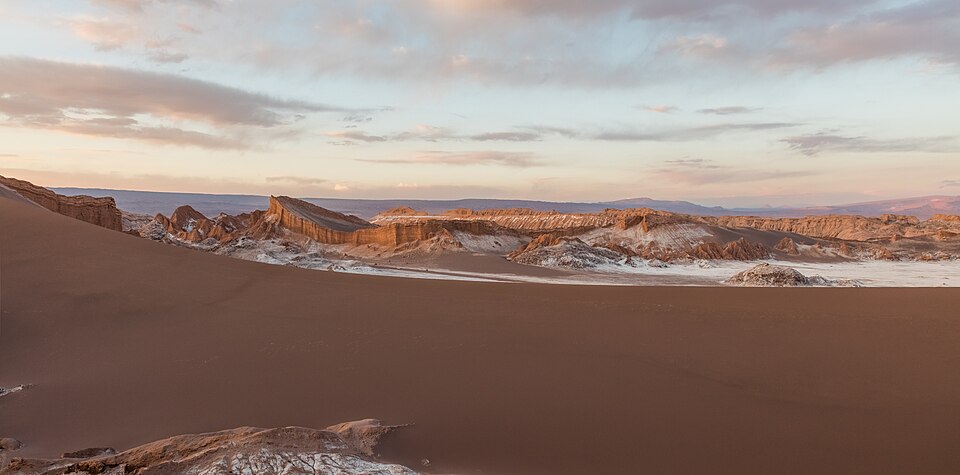
Diego Delso, CC BY-SA 4.0, via Wikimedia Commons
i
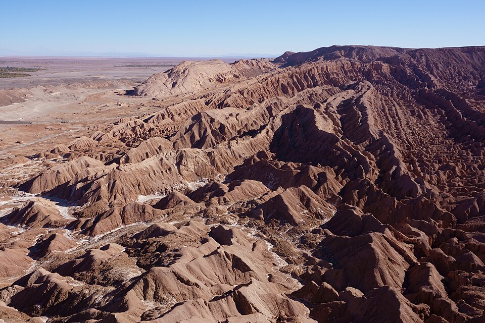
kallerna, CC BY-SA 4.0, via Wikimedia Commons
i
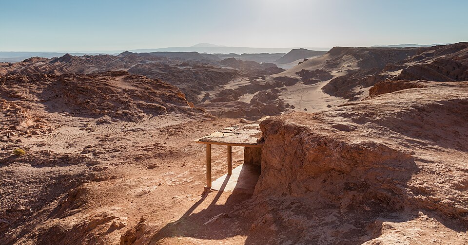
Diego Delso, CC BY-SA 4.0, via Wikimedia Commons
i
Luca Galuzzi (Lucag), CC BY-SA 2.5, via Wikimedia Commons
What San Pedro de Atacama is like
San Pedro de Atacama is a town of 3,899 (2012) in Northern Chile. San Pedro is a very popular destination among Chilean tourists and international visitors looking for a desert experience and a stepping stone to the amazing landscapes around it. More on Wikivoyage
- Worth seeing
- In the following the essential places to visit around San Pedro. The description takes emphasis on the tours offered from San Pedro, but the sights can also be visited without a tour. More on Wikivoyage
- Worth doing
- Exploring San Pedro by bicycle can be an authentic and less stressful way to travelling. More on Wikivoyage
- Getting in
- Terminal de Buses, Tumisa Road (Inside Craft Village, about 1 km southeast of the city centre.). More on Wikivoyage
- Staying safe
- You can rest assured that there's virtually no violent crime in San Pedro. However, the theft of bicycles and cars happens every once in a while, so take the normal precautions in that regard. More on Wikivoyage
- Staying healthy
- First of all, always remember that the altitude of San Pedro de Atacama is 2,400 m (7,900 ft) above sea level. Some of the tourist attractions are well above 4,000 m (13,000 ft). More on Wikivoyage
From the Wikivoyage article on San Pedro de Atacama, written by travellers and licensed CC BY-SA 4.0; the full article has far more. The numbers above are measured; this is experience.
Around San Pedro de Atacama
Also in Chile
- Easter Island best Jun, Oct, Dec
- Punta Arenas best Jan, Feb, Oct
- Santiago best Feb, Mar, Oct
- Torres del Paine best Jan, Feb, Dec
- Valle Nevado best Feb, Jul, Aug
- Valparaíso best Apr, May, Oct
Nearby
Kind of place
San Pedro de Atacama is in Chile, Latin America. Distances are great-circle, so a short one can still be a long way round.
Check your inbox. A confirmation is on its way: open the link in it, press Confirm, and you are subscribed.
That did not go through. Check the address, or try again in a minute.
Already sent. A confirmation went to that address in the last day: look for it, spam folder included. Its link works for three days.
You are not on the list until you confirm from your inbox. The list lives with our email provider, Resend; the privacy page says the rest.
Links marked Ad pay us a commission if you book through one, at no extra cost to you. That does not affect the scores on this page, which are computed from climate and fare data before any link is built.