

Best time to visit Fire Island
United States · North America
All twelve months scored on daily temperature, rainfall, humidity and holiday crowding.
The year in Fire Island
Tap a month for its page
- JanJFire Island in January: avoid
- FebFFire Island in February: avoid
- MarMFire Island in March: ok
- AprAFire Island in April: good
- MayMFire Island in May: sweet spot
- JunJFire Island in June: good, busy
- JulJFire Island in July: good, busy
- AugAFire Island in August: good, busy
- SepSFire Island in September: sweet spot
- OctOFire Island in October: sweet spot
- NovNFire Island in November: ok
- DecDFire Island in December: ok
- Sweet spot
- Good
- OK
- Avoid
- Busy
Plan this trip
Each site opens on its own search: choose your dates there. A few open on their home page, where you type the place too.
Links marked Ad pay us a commission if you book, at no extra cost to you; most pay nothing, and what a site pays never decides whether it is listed or where. How we rank
Flights from
Flights
Your city is a guess from your time zone. Choose your city
Where are you flying from? Choose your city for its flights.
Book with the airline
Where to stay
Book direct
Luxury
Things to do
Car hire
Rent direct
Travel insurance
Check whether your bank card or home insurance already covers this trip.
If the trip needs a visa, the travel agent or visa centre usually sells the cover it asks for.
Mobile data (eSIM)
Your own plan's EU roaming may already cover this.
Renting a pocket Wi-Fi is the other common way to stay connected.
These are sites people in book with. Each opens in a new tab, on the site's own pages.
Month by month
| Month | Max °C | Rain days | Humidity | Sun h/day | Verdict | Why |
|---|---|---|---|---|---|---|
| Jan | 4° | 8d | 68% | 6.2h | avoid | bitter cold: 4C daily max |
| Feb | 5° | 9d | 71% | 6.8h | avoid | bitter cold: 5C daily max |
| Mar | 9° | 9d | 69% | 8.3h | ok | 9C max, 9 rainy days |
| Apr | 13° | 10d | 73% | 8.9h | good | 13C max, 10 rainy days |
| May | 18° | 10d | 77% | 9.9h | sweet spot | 18C max, 10 rainy days |
| Jun | 23° | 7d | 79% | 11.4h | goodbusy | busier than usual |
| Jul | 26° | 8d | 81% | 11.7h | goodbusy | busier than usual |
| Aug | 26° | 8d | 79% | 10.9h | goodbusy | busier than usual |
| Sep | 23° | 8d | 77% | 9.2h | sweet spot | 23C max, 8 rainy days |
| Oct | 18° | 8d | 76% | 8.0h | sweet spot | 18C max, 8 rainy days |
| Nov | 12° | 9d | 69% | 7.0h | ok | 12C max, 9 rainy days |
| Dec | 7° | 9d | 72% | 5.7h | ok | 7C max, 9 rainy days |
Rain days are the days with at least 1 mm of rain, as a weather station counts them.
Weather read at Ocean Beach, the main village: ten years of ERA5 and ERA5-Land reanalysis, through Open-Meteo's open data.
A busy month is a crowded one, not a bad one — usually it is crowded because the weather is good. It is flagged rather than scored down, and crowds alone never make a month “avoid”: that is reserved for weather worth skipping.
How busy it gets
Then and now
Fire Island's April days now average 12.9°C, 1.8°C warmer than in 1981–1990. 8 of 12 months are clearly warmer.
| Jan | Feb | Mar | Apr | May | Jun | Jul | Aug | Sep | Oct | Nov | Dec | |
|---|---|---|---|---|---|---|---|---|---|---|---|---|
| 1981–90 | 2.8° | 4.2° | 6.9° | 11.1° | 16.3° | 21.8° | 25.1° | 24.6° | 21.4° | 16.4° | 11.8° | 6.4° |
| 2017–26 | 4.3° | 5.3° | 8.5° | 12.9° | 17.7° | 23.0° | 26.5° | 26.0° | 23.0° | 18.0° | 11.9° | 6.8° |
| Change | +1.5° | +1.1° | +1.7° | +1.8° | +1.4° | +1.2° | +1.4° | +1.4° | +1.6° | +1.6° | +0.1° | +0.4° |
The average daily high, month by month, for the nearest ERA5 grid cell. Bold is a clear change; grey is within the ordinary spread between years. Every destination, ranked.
Getting there
Fly into Islip (ISP), then drive. The flights under Where to book are to Islip.
| Islip (ISP) | the drive is not measured yet |
|---|---|
| NYC | the drive is not measured yet |
The drive from each airport is the road's, from openrouteservice.org by HeiGIT: typical, not a schedule.
How far Fire Island is depends on where you set off from — the months above do not.
- from Boston
- from Washington DC
- from Montreal
- from Ottawa
- from Toronto
- from Detroit
- from Charlotte
- from Chicago
Open in Rome2rio for every way from to Fire Island, flying or not.
Before you go
Type A and B plugs at 120 V. Drives on the right. The currency is the United states dollar. No UK Foreign Office advice against travel. Global Affairs Canada: Exercise normal security precautions. Everything for United States: cost of living, languages, emergency numbers and health.
Being there
On arrival
- Paying — Cards, Apple Pay and Google Pay work almost everywhere, though a few small places take cash only. Keep some $1 and $5 notes for tips; Venmo and PayPal are for locals.
- UPI, for visitors from India — Not accepted for paying here; bring a card that works abroad.
- Tipping — Expected: 15–20% in sit-down restaurants (18–20% is standard in New York) and 10–20% for taxi, Uber and Lyft drivers. Large groups may find it already on the bill.
Getting around Fire Island
- Apps — Rides: Lyft, Uber. Maps: Google Maps, Apple Maps. Messages: Text messages (SMS), WhatsApp. In San Francisco, Los Angeles, Miami and some other cities you can also book a driverless Waymo in its own app.
There are three easy ways to get around on Fire Island. The first is to walk. More on Wikivoyage
From the Wikivoyage article on Fire Island, written by travellers and licensed CC BY-SA 4.0.
Help
- Emergency — 911 (any emergency).
TravelCharika is not an emergency service: we cannot call for help or send anyone. Numbers can change; if one fails, ask someone local or your hotel.
Your embassy — : how to reach your embassy or consulate abroad. A guess from your city, : a city is not a passport.
Put together by hand from the sources listed, checked 7 October 2026. Apps, cards and rules change, so check before you rely on one.
Sources (50)
- gov.uk/foreign-travel-advice/usa/getting-help
- omny.info
- omny.info/fares
- clippercard.com/contactless-payments
- clippercard.com/pay-with-phone
- mtc.ca.gov/news/starting-wednesday-bart-riders-can-tap-bank-cards
- sfcta.org/blogs/next-generation-clipper-tap-pay-here
- metro.net/fares/how-to-pay
- transitchicago.com/howto/pay-for-your-fare
- info.myorca.com/contactless
- miamidade.gov/global/service.page?Mduid_service=ser1565197498854306
- mbta.com/fares/charlie/tap-ride
- holocard.net/for-visitors
- holocard.net/help
- sdmts.com/fares/pronto-ways-pay
- ridepronto.com
- norta.com/ride-with-us/how-to-pay
- norta.com/ride-with-us/how-to-pay/fares
- norta.com/ride-with-us/how-to-pay/lepass
- capmetro.org/fares
- wmata.com/fares
- wmata.com/pay/tap-ride-go.html
- muni.org/Departments/transit/PeopleMover/Pages/FaresandPasses.aspx
- uber.com/global/en/cities/new-york
- lyft.com/rider/cities/new-york-ny
- waymo.com/faq
- visittheusa.com/travel-trade/faq
- nyctourism.com/tipping-sales-tax
- en.wikivoyage.org/wiki/United_States
- infobip.com/blog/most-popular-messaging-apps-by-country
- developers.google.com/maps/coverage
- apple.com/ios/feature-availability
- visitphilly.com/things-to-do/attractions/septa
- lvmonorail.com/ticket-information
- lvmonorail.com/frequently-asked-questions
- apps.apple.com/us/app/ridertc/id909691507
- lasvegasnevada.gov/News/Blog/Detail/your-guide-to-exploring-las-vegas-bus-it-bike-it-or-share-it
- visitlasvegas.com/plan/getting-here-and-around/maps
- visitlasvegas.com/experience/post/getting-around-vegas
- visitlasvegas.com/experience/post/vegas-on-budget
- wegotransit.com/buy/fare-information
- wegotransit.com/wego-now-accepts-credit-card-mobile-wallet-contactless-payment
- wegotransit.com/ride/transit-services/airport
- trimet.org/fares
- trimet.org/schedules/maxredline.htm
- rtd-denver.com/fares-passes/fares
- rtd-denver.com/fares-passes/tap-n-ride
- app.rtd-denver.com/en-US/route/A/schedule
- pib.gov.in/PressReleasePage.aspx?PRID=2286608
- rbidocs.rbi.org.in/rdocs/AnnualReport/PDFs/09PAYMENT290526C6588B796E664822A2BD0DEB6452CAD4.PDF
Fire Island in pictures
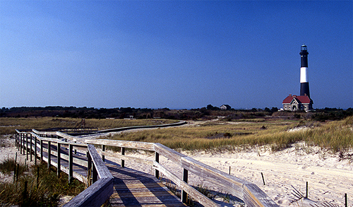
i
Skip willits, Public domain, via Wikimedia Commons
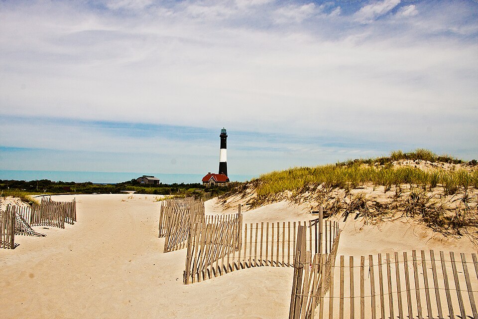
i
Erik Anestad from USA, CC BY 2.0, via Wikimedia Commons
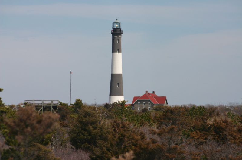
i
Jeff Pearce, CC BY 2.0, via Wikimedia Commons
What Fire Island is like
Fire Island is a 32-mile (51.5-km) barrier island off the coast of Long Island in Suffolk County, New York. Most of Fire Island National Seashore is on the island. More on Wikivoyage
- Worth seeing
- Fire Island National Seashore. Includes a wilderness area with backcountry camping by permit. Sunken forest on 40 acres. More on Wikivoyage
- Worth doing
- Robert Moses State Park. Western end of the island. Swim, surf, fish, picnic. More on Wikivoyage
- Getting in
- Most of these methods of getting in must be used in combination. For example, to reach Fair Harbor from Manhattan, you could take the LIRR, then a taxi from the train to the ferry, and then the ferry to the Island. More on Wikivoyage
- Staying safe
- Stay on marked trails so as avoid poison ivy and ticks. Deer ticks can be carriers of Lyme Disease. More on Wikivoyage
From the Wikivoyage article on Fire Island, written by travellers and licensed CC BY-SA 4.0; the full article has far more. The numbers above are measured; this is experience.
Around Fire Island
Also in United States
- Acadia best May, Jul, Aug
- Anaheim best Apr, May, Oct
- Anchorage best Apr, May, Jun
- Asheville best Apr, Sep, Oct
- Aspen best Mar, Apr, Jun
- Astoria best Jul, Aug, Sep
- Atlanta best Apr, May, Sep
- Atlantic City best Apr, May, Sep
- Austin best Feb, May, Oct
- Badlands best Aug, Sep, Oct
- Bend best May, Aug, Sep
- Big Island best Jan, Mar, Oct
- Big Sur best Apr, Sep, Oct
- Biloxi best Apr, May, Oct
- Block Island best Aug, Sep, Oct
- Boston best May, Aug, Sep
- Boulder best May, Jun, Aug
- Burlington best May, Jun, Sep
- Cape Cod best Jul, Aug, Oct
- Carmel-by-the-Sea best May, Sep, Oct
- Charleston best Mar, Apr, Oct
- Charlotte best Apr, May, Oct
- Charlottesville best Mar, Apr, May
- Chicago best May, Jun, Sep
- Coeur d'Alene best May, Aug, Sep
- Dallas best Apr, May, Oct
- Daytona Beach best Apr, May, Oct
- Deadwood best May, Aug, Sep
- Death Valley best Apr, Oct, Nov
- Denver best Apr, Sep, Oct
- Detroit best May, Jun, Sep
- Eureka best May, Aug, Oct
- Fairbanks best May, Jun, Jul
- Flagstaff best May, Jun, Aug
- Fort Lauderdale best Mar, Apr, May
- Fort Myers best Apr, May, Oct
- Galveston best Apr, Sep, Oct
- Glacier National Park best Jul, Aug, Sep
- Houston best Apr, May, Oct
- Jackson Hole best Mar, Aug, Sep
- Joshua Tree best Apr, May, Oct
- Juneau best Jun
- Kauaʻi best Jan, Feb, Oct
- Key West best Mar, Apr, May
- Lafayette best Apr, May, Oct
- Laguna Beach best Apr, May, Sep
- Lake Tahoe best Mar, May, Oct
- Lake of the Ozarks best Apr, Sep, Oct
- Lanai best Apr, May, Sep
- Las Vegas best Mar, Apr, Oct
- Los Angeles best Apr, May, Sep
- Mackinac Island best Jul, Aug, Sep
- Martha's Vineyard best May, Aug, Oct
- Maui best May, Sep, Oct
- Miami best Feb, Apr, May
- Minneapolis best May, Jul, Sep
- Mount Hood best Jul, Aug, Sep
- Myrtle Beach best Apr, May, Oct
- Nantucket best Jul, Aug, Oct
- Naples best Apr, May, Oct
- Nashville best May, Sep, Oct
- New Orleans best Mar, Apr, May
- New York best Apr, May, Sep
- Newport best May, Aug, Sep
- Oahu best May, Sep, Oct
- Ojai best Apr, May, Oct
- Orlando best Mar, Apr, Oct
- Outer Banks best Apr, May, Oct
- Palm Springs best Apr, Oct, Nov
- Panama City Beach best Apr, May, Oct
- Park City best Feb, Mar, Jun
- Philadelphia best Apr, May, Sep
- Phoenix best Feb, Apr, Oct
- Portland best May, Aug, Sep
- Portland best May, Jul, Aug
- Put-in-Bay best Jul, Aug, Sep
- Salt Lake City best May, Sep, Oct
- San Antonio best Mar, Apr, Oct
- San Diego best Apr, May, Sep
- San Francisco best Apr, May, Oct
- Santa Barbara best Apr, May, Sep
- Santa Catalina Island best Apr, Jun, Sep
- Santa Cruz best Apr, May, Oct
- Santa Fe best Apr, Sep, Oct
- Sarasota best Apr, May, Oct
- Saratoga Springs best May, Aug, Sep
- Savannah best Feb, Apr, Oct
- Scottsdale best Mar, Apr, Oct
- Seattle best May, Jul, Aug
- Sedona best Apr, May, Aug
- Sequoia and Kings Canyon best Aug, Sep, Oct
- Sitka best May, Jun, Jul
- South Padre Island best Apr, May, Oct
- St. Augustine best Apr, May, Oct
- Tampa best Mar, Apr, Oct
- Taos best Apr, Aug, Sep
- Temecula best Apr, May, Sep
- The Grand Canyon best Apr, May, Oct
- The Hamptons best Jun, Sep, Oct
- Vail best Jun, Aug, Sep
- Virginia Beach best Apr, Sep, Oct
- Washington DC best Apr, May, Oct
- Williamsburg best Apr, May, Jun
- Yellowstone best Jul, Aug, Sep
- Yosemite best Aug, Sep, Oct
- Zion best Apr, May, Oct
Nearby
Kind of place
Fire Island is in United States, North America. Distances are great-circle, so a short one can still be a long way round.
Check your inbox. A confirmation is on its way: open the link in it, press Confirm, and you are subscribed.
That did not go through. Check the address, or try again in a minute.
Already sent. A confirmation went to that address in the last day: look for it, spam folder included. Its link works for three days.
You are not on the list until you confirm from your inbox. The list lives with our email provider, Resend; the privacy page says the rest.
Links marked Ad pay us a commission if you book through one, at no extra cost to you. That does not affect the scores on this page, which are computed from climate and holiday data before any link is built.