

i
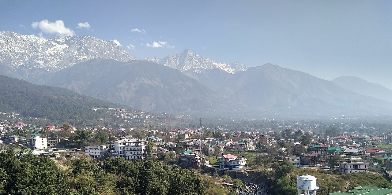
Photo by Amit Phulera, CC BY-SA 4.0, via Wikimedia Commons.
Best time to visit Dharamshala
India · South Asia
All twelve months scored on daily temperature, rainfall, humidity and holiday crowding.
The year in Dharamshala
Tap a month for its page
- JanJDharamshala in January: ok
- FebFDharamshala in February: good
- MarMDharamshala in March: good, busy
- AprADharamshala in April: good, busy
- MayMDharamshala in May: good, busy
- JunJDharamshala in June: sweet spot
- JulJDharamshala in July: avoid
- AugADharamshala in August: avoid
- SepSDharamshala in September: avoid
- OctODharamshala in October: sweet spot
- NovNDharamshala in November: good
- DecDDharamshala in December: ok, busy
- Sweet spot
- Good
- OK
- Avoid
- Busy
Plan this trip
Each site opens on its own search: choose your dates there. A few open on their home page, where you type the place too.
Links marked Ad pay us a commission if you book, at no extra cost to you; most pay nothing, and what a site pays never decides whether it is listed or where. How we rank
Flights from
Flights
Your city is a guess from your time zone. Choose your city
Where are you flying from? Choose your city for its flights and fares.
Book with the airline
Where to stay
Book direct
Luxury
Things to do
Car hire
Rent direct
Travel insurance
Check whether your bank card or home insurance already covers this trip.
If the trip needs a visa, the travel agent or visa centre usually sells the cover it asks for.
Mobile data (eSIM)
Your own plan's EU roaming may already cover this.
Renting a pocket Wi-Fi is the other common way to stay connected.
These are sites people in book with. Each opens in a new tab, on the site's own pages.
Things to do in Dharamshala
- Baijnath Temple, Himachal Pradesh Early 13th century Shiva temple
- Vajreshwari Devi Temple, Kangra A Hindu temple in Himachal Pradesh, Shakti Peetha tirtha
- Shri Chamunda Devi Mandir Hindu temple in Kangra district, Himachal Pradesh, India
- Triund If you are in for a brisk walk, climb the hill beyond Dharamkot to Triund ridge.
- Masroor Temples 8th-century rock cut stone temple and ruins in Masrur–Lahalpur Himachal Pradesh
- Jwala Ji Kangra 7th century Hindu goddess temple and pilgrimage site
- St. John in the Wilderness Church Church in Dharamshala, Himachal Pradesh, India
Tours and tickets in Dharamshala
Each site opens on its own search: choose your dates there. A few open on their home page, where you type the place too. Links marked Ad pay us a commission if you book, at no extra cost to you; most pay nothing, and what a site pays never decides whether it is listed or where. How we rank
Sights and their lines from Wikivoyage (Dharamsala), licensed CC BY-SA 4.0, and Wikidata; in order of how often each one's Wikipedia article was read on phones in the last 12 months.
Month by month
No fare history for this route yet, so this ranking is climate and crowds only — the price column will fill in as the scanner collects.
| Month | Max °C | Rain days | Humidity | Sun h/day | Verdict | Why |
|---|---|---|---|---|---|---|
| Jan | 10° | 8d | 54% | 8.2h | ok | 10C max, 8 rainy days |
| Feb | 12° | 6d | 56% | 8.9h | good | 12C max, 6 rainy days |
| Mar | 16° | 8d | 53% | 9.9h | goodbusy | busier than usual |
| Apr | 21° | 8d | 45% | 10.8h | goodbusy | busier than usual |
| May | 24° | 8d | 46% | 11.4h | goodbusy | busier than usual |
| Jun | 25° | 11d | 60% | 11.6h | sweet spot | 25C max, 11 rainy days |
| Jul | 22° | 25d | 85% | 9.1h | avoid | monsoon: 25 rainy days, 473mm |
| Aug | 22° | 28d | 88% | 9.0h | avoid | monsoon: 28 rainy days, 463mm |
| Sep | 21° | 21d | 80% | 10.4h | avoid | monsoon: 21 rainy days, 201mm |
| Oct | 19° | 5d | 63% | 10.5h | sweet spot | 19C max, 5 rainy days |
| Nov | 15° | 3d | 58% | 9.2h | good | 15C max, 3 rainy days |
| Dec | 12° | 2d | 50% | 8.9h | okbusy | busier than usual |
Rain days are the days with at least 1 mm of rain, as a weather station counts them.
Weather read at McLeod Ganj, the upper town, 10 km from the airport (DHM): ten years of ERA5 and ERA5-Land reanalysis, through Open-Meteo's open data.
A busy month is a crowded one, not a bad one — usually it is crowded because the weather is good. It is flagged rather than scored down, and crowds alone never make a month “avoid”: that is reserved for weather worth skipping.
How busy it gets
Then and now
Dharamshala's February days now average 11.9°C, 2.3°C warmer than in 1981–1990. 4 of 12 months are clearly warmer, 1 clearly cooler.
| Jan | Feb | Mar | Apr | May | Jun | Jul | Aug | Sep | Oct | Nov | Dec | |
|---|---|---|---|---|---|---|---|---|---|---|---|---|
| 1981–90 | 8.5° | 9.6° | 14.0° | 19.3° | 23.8° | 25.9° | 22.6° | 21.7° | 21.1° | 18.6° | 14.7° | 10.5° |
| 2017–26 | 9.7° | 11.9° | 16.1° | 21.0° | 23.8° | 24.8° | 22.5° | 21.9° | 21.3° | 19.0° | 14.9° | 11.8° |
| Change | +1.2° | +2.3° | +2.1° | +1.6° | -0.1° | -1.1° | -0.2° | +0.2° | +0.2° | +0.3° | +0.2° | +1.3° |
The average daily high, month by month, for the nearest ERA5 grid cell. Bold is a clear change; grey is within the ordinary spread between years. Every destination, ranked.
Getting there
How far Dharamshala is, and what it costs, depends on where you set off from — the months above do not.
- from Delhi
- from Ahmedabad
- from Mumbai
- from Kolkata
- from Hyderabad
- from Bengaluru
- from Chennai
- from Dubai
Open in Rome2rio for every way from to Dharamshala, flying or not.
Before you go
Type C and D plugs at 230 V. Drives on the left. The currency is the Indian rupee. UK Foreign Office: avoid all travel to parts. Global Affairs Canada: Exercise a high degree of caution (with regional advisories). US State Department: Level 2: Exercise Increased Caution. Everything for India: cost of living, languages, emergency numbers and health.
Being there
On arrival
- Paying — Cards are taken at larger hotels, chain stores and many restaurants; small shops and family-run businesses rarely take them, so carry some cash.
- Tipping — Not traditional; up to 10% is usual only in smarter restaurants. Taxi and auto-rickshaw drivers do not expect a tip.
Getting around Dharamshala
- Apps — Rides: Ola, Rapido, Uber. Maps: Google Maps, Apple Maps. Messages: WhatsApp. The apps also book auto-rickshaws, and bike taxis where these are allowed.
Dharamsala is divided into several distinct areas that are separated by a 15 min or 12 km bus or jeep ride at most: Lower Dharamsala – Consists of most of the government offices, Schools, the local hospital… More on Wikivoyage
From the Wikivoyage article on Dharamsala, written by travellers and licensed CC BY-SA 4.0.
Help
- Emergency — 112 (any emergency).
TravelCharika is not an emergency service: we cannot call for help or send anyone. Numbers can change; if one fails, ask someone local or your hotel.
Your embassy — : how to reach your embassy or consulate abroad. A guess from your city, : a city is not a passport.
Put together by hand from the sources listed, checked 3 October 2026. Apps, cards and rules change, so check before you rely on one.
Sources (29)
- gov.uk/foreign-travel-advice/india/getting-help
- en.wikivoyage.org/wiki/India
- en.wikivoyage.org/wiki/Bengaluru
- en.wikivoyage.org/wiki/Goa
- uber.com/global/en/cities/new-delhi
- rapido.bike
- olacabs.com
- en.wikipedia.org/wiki/Delhi_Metro
- en.wikipedia.org/wiki/National_Common_Mobility_Card
- outlookindia.com/national/delhi-metro-s-whatsapp-based-ticketing-service-now-available-on-all-corridors-dmrc-news-322653
- newsonair.gov.in/delhi-metro-to-start-selling-tourist-smart-cards-from-today-at-selected-metro-stations
- pib.gov.in/PressReleasePage.aspx?PRID=2175641
- theprint.in/india/pm-launches-mumbai-one-single-app-for-all-public-transport-tickets/2760053
- knocksense.com/mumbai/mumbai-metros-new-national-common-mobility-card-now-active-on-4-key-lines-best-buses
- english.bmrc.co.in/tickets
- chennaimetrorail.org/technology/it-afc
- chennaimetrorail.org/singara-chennai-card
- ltmetro.com/ticketing
- en.wikipedia.org/wiki/Kolkata_Metro
- mtp.indianrailways.gov.in/view_detail.jsp?lang=0&id=0,4,268&dcd=5616&did=17718442840108B0DB2498F6DE92F3B9760F2EC147116
- gujaratmetrorail.com/ahmedabad
- kochimetro.org/kochi-1-card
- onmanorama.com/travel/travel-news/2024/01/09/book-kochi-metro-tickets-on-whatsapp.html
- play.google.com/store/apps/details?id=com.transitfe
- en.wikipedia.org/wiki/Jaipur_Metro
- transport.rajasthan.gov.in/content/dam/transport/metro/Passenger%20Information/Types%20of%20Tickets/Jaipur%20Metro%20Fare%20Products-31.01.2025.pdf
- goamiles.com
- developers.google.com/maps/coverage
- apple.com/ios/feature-availability
Dharamshala in pictures
i
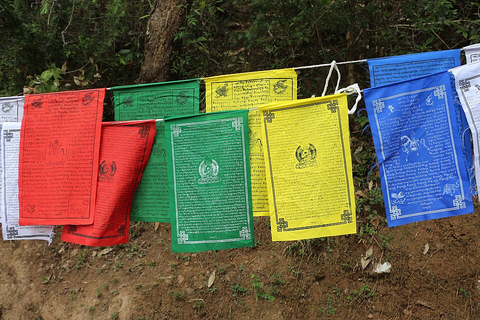
Bernard Gagnon, CC BY-SA 4.0, via Wikimedia Commons
i
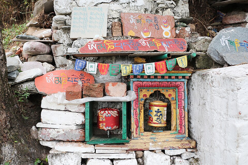
Bernard Gagnon, CC BY-SA 4.0, via Wikimedia Commons
i
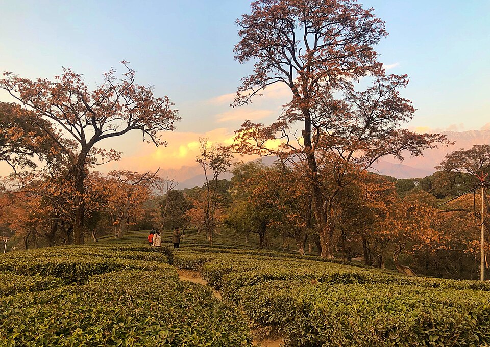
UnpetitproleX, CC BY-SA 4.0, via Wikimedia Commons
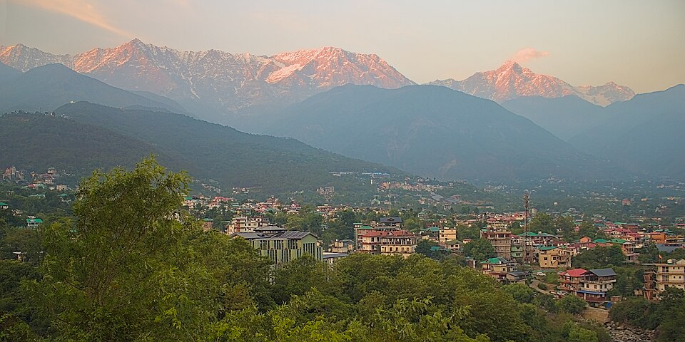
i
UnpetitproleX, CC BY-SA 4.0, via Wikimedia Commons
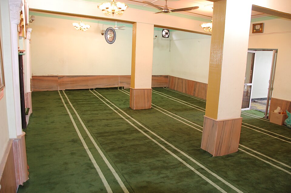
i
Masjid,Dharamshala,HimachlPradesh, CC BY-SA 3.0, via Wikimedia Commons
What Dharamshala is like
Dharamsala or Dharamshala (Hindi: धर्मशाला Dharmshālā; Tibetan: དྷ་རམ་ས་ལ་), is a hill station in Himachal Pradesh, famed for its large Tibetan community centred on the activities of the Dalai Lama. More on Wikivoyage
- Worth seeing
- HPCA Cricket Stadium (HPCA Cricket Academy) (in Dharamsala.). The picturesque Himachal Pradesh Cricket Association Stadium is unique in India as it is situated at an altitude of 1,457 m above the sea level and has the… More on Wikivoyage
- Worth doing
- Roam around. McLeod Ganj is a beautiful place to roam around on foot. More on Wikivoyage
- Getting in
- Kangra Airport (DHM IATA) is at Gaggal near Kangra, a distance of 15 km from McLeod Ganj by road on MDR44 and NH 154. Dharamshala ISBT Bus Stand. Most people arrive in Lower Dharamsala by bus. More on Wikivoyage
- Staying safe
- The place is safe, though it is advisable to take precautions. Stay vigilant at all times and be very cautious if staying out after 9PM. More on Wikivoyage
From the Wikivoyage article on Dharamsala, written by travellers and licensed CC BY-SA 4.0; the full article has far more. The numbers above are measured; this is experience.
Around Dharamshala
Also in India
- Agartala best Jan, Feb, Dec
- Agra best Feb, Mar, Nov
- Ahmedabad best Jan, Feb, Nov
- Aizawl best Feb, Mar, Apr
- Amritsar best Feb, Mar, Oct
- Aurangabad best Jan, Feb, Dec
- Ayodhya best Jan, Feb, Mar
- Badrinath best May, Oct, Nov
- Bengaluru best Jan, Feb, Nov
- Bodh Gaya best Jan, Feb, Mar
- Chennai best Jan, Feb, Oct
- Cherrapunji best Feb, Nov, Dec
- Coorg best Jan, Feb, Mar
- Darjeeling best Oct, Nov, Dec
- Delhi best Jan, Feb, Mar
- Dwarka best Feb, Jun, Oct
- Gangtok best Jan, Nov, Dec
- Goa best Jan, Feb, Oct
- Guwahati best Jan, Feb, Dec
- Gwalior best Jan, Feb, Mar
- Hampi best Jul, Aug, Nov
- Haridwar best Mar, Oct, Nov
- Hyderabad best Feb, Oct, Nov
- Jaipur best Feb, Mar, Oct
- Jaisalmer best Feb, Mar, Nov
- Jodhpur best Feb, Mar, Nov
- Kanyakumari best Feb, Jun, Jul
- Kaziranga best Jan, Feb, Mar
- Kedarnath best May, Oct
- Kochi best Jan, Feb, Mar
- Kohima best Jan, Feb, Mar
- Kolkata best Jan, Feb, Nov
- Lakshadweep best Feb, Mar, Apr
- Leh best Jul, Sep, Oct
- Lucknow best Feb, Mar, Nov
- Madurai best Jan, Feb, Dec
- Majuli best Jan, Feb, Nov
- Manali best Apr, Sep, Oct
- Mumbai best Jan, Feb, Mar
- Munnar best Jan, Feb, Mar
- Murdeshwar best Jan, Feb, Mar
- Mussoorie best Apr, Oct, Nov
- Mysuru best Jan, Feb, Jun
- Omkareshwar best Jan, Feb, Nov
- Ooty best Jan, Feb, Mar
- Pondicherry best Jan, Feb, Dec
- Puri best Jan, Feb, Mar
- Rameswaram best Apr, Jun, Jul
- Rishikesh best Feb, Oct, Nov
- Shillong best Feb, Mar, Dec
- Shimla best Apr, Jun, Oct
- Srisailam best Feb, Jul, Nov
- Tawang best Sep, Oct, Dec
- Tezpur best Jan, Feb, Mar
- The Andaman Islands best Jan, Feb, Mar
- Thiruvananthapuram best Jan, Feb, Mar
- Tirupati best Jan, Feb, Dec
- Tiruvannamalai best Jan, Feb, Dec
- Udaipur best Feb, Mar, Oct
- Ujjain best Jan, Feb, Oct
- Varanasi best Jan, Feb, Nov
- Visakhapatnam best Feb, Mar, Nov
- Vrindavan best Feb, Oct, Nov
Nearby
- Kathmandu Nepal · 1,006 km
- Mount Everest Nepal · 1,114 km
- Samarkand Uzbekistan · 1,177 km
- Tashkent Uzbekistan · 1,187 km
Kind of place
Dharamshala is in India, South Asia. Distances are great-circle, so a short one can still be a long way round.
Check your inbox. A confirmation is on its way: open the link in it, press Confirm, and you are subscribed.
That did not go through. Check the address, or try again in a minute.
Already sent. A confirmation went to that address in the last day: look for it, spam folder included. Its link works for three days.
You are not on the list until you confirm from your inbox. The list lives with our email provider, Resend; the privacy page says the rest.
Links marked Ad pay us a commission if you book through one, at no extra cost to you. That does not affect the scores on this page, which are computed from climate and fare data before any link is built.