

Miami or Oahu?
7,820 km apart, both in United States. Each is scored month by month on the same ten years of climate readings, the public holidays that crowd it, and what the flight costs. This is where they part, and when.
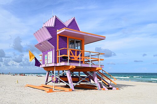
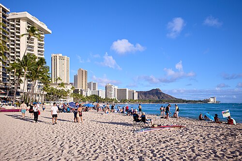
Month by month
| Month | Jan | Feb | Mar | Apr | May | Jun | Jul | Aug | Sep | Oct | Nov | Dec |
|---|---|---|---|---|---|---|---|---|---|---|---|---|
| Miami | 24° 6d | 25° 4d | 26° 4d | 28° 6d | 29° 8d | 30° 12d | 31° 10d | 31° 11d | 30° 13d | 29° 9d | 27° 5d | 25° 6d |
| Oahu | 26° 4d | 25° 5d | 26° 5d | 27° 5d | 27° 4d | 28° 2d | 29° 2d | 30° 2d | 30° 2d | 29° 2d | 28° 2d | 26° 4d |
| Pick | either | Miami | Miami | Miami | Miami | Oahu | Oahu | Oahu | Oahu | Oahu | Oahu | Oahu |
- Sweet spot
- Good
- OK
- Avoid
- Busy
Each cell is that destination's own verdict for the month — sweet spot, ok or avoid — with its typical daily high and its rainy days ("11d": days with at least 1 mm of rain, as a weather station counts them). The pick goes to the better verdict; with the same verdict, to the higher score, unless the two are within a whisker of each other, when it is either. A month both would avoid is neither. A dot marks a busy month.
Before you go
Both are in United States, so the currency, the plugs and the travel advice are the same: type A and B plugs, driving on the right, paying in the United states dollar. Everything for United States.
On arrival
- Apps — Rides: Lyft, Uber. Maps: Google Maps, Apple Maps. Messages: Text messages (SMS), WhatsApp. In San Francisco, Los Angeles, Miami and some other cities you can also book a driverless Waymo in its own app.
- Paying — Cards, Apple Pay and Google Pay work almost everywhere, though a few small places take cash only. Keep some $1 and $5 notes for tips; Venmo and PayPal are for locals.
- UPI, for visitors from India — Not accepted for paying here; bring a card that works abroad.
- Getting around Miami — Tap a contactless bank card or phone at Metrorail gates and on Metrobus, with a daily fare cap. An EASY Card works too.
- Getting around Oahu — Buy a HOLO card with a 1-, 3- or 7-day pass from a HOLO machine at any Skyline station or an ABC Store in Waikīkī, and tap it on TheBus and at Skyline stations, again at the gate on the way out. TheBus also takes cash for a single ride; Skyline needs a HOLO card.
- Tipping — Expected: 15–20% in sit-down restaurants (18–20% is standard in New York) and 10–20% for taxi, Uber and Lyft drivers. Large groups may find it already on the bill.
- Emergency — 911 (any emergency).
TravelCharika is not an emergency service: we cannot call for help or send anyone. Numbers can change; if one fails, ask someone local or your hotel.
Put together by hand from the sources listed, checked 5 October 2026. Apps, cards and rules change, so check before you rely on one.
Sources (34)
- gov.uk/foreign-travel-advice/usa/getting-help
- omny.info
- omny.info/fares
- clippercard.com/contactless-payments
- clippercard.com/pay-with-phone
- mtc.ca.gov/news/starting-wednesday-bart-riders-can-tap-bank-cards
- sfcta.org/blogs/next-generation-clipper-tap-pay-here
- metro.net/fares/how-to-pay
- transitchicago.com/howto/pay-for-your-fare
- info.myorca.com/contactless
- miamidade.gov/global/service.page?Mduid_service=ser1565197498854306
- mbta.com/fares/charlie/tap-ride
- holocard.net/for-visitors
- holocard.net/help
- sdmts.com/fares/pronto-ways-pay
- ridepronto.com
- norta.com/ride-with-us/how-to-pay
- norta.com/ride-with-us/how-to-pay/fares
- norta.com/ride-with-us/how-to-pay/lepass
- capmetro.org/fares
- wmata.com/fares
- wmata.com/pay/tap-ride-go.html
- muni.org/Departments/transit/PeopleMover/Pages/FaresandPasses.aspx
- uber.com/global/en/cities/new-york
- lyft.com/rider/cities/new-york-ny
- waymo.com/faq
- visittheusa.com/travel-trade/faq
- nyctourism.com/tipping-sales-tax
- en.wikivoyage.org/wiki/United_States
- infobip.com/blog/most-popular-messaging-apps-by-country
- developers.google.com/maps/coverage
- apple.com/ios/feature-availability
- pib.gov.in/PressReleasePage.aspx?PRID=2286608
- rbidocs.rbi.org.in/rdocs/AnnualReport/PDFs/09PAYMENT290526C6588B796E664822A2BD0DEB6452CAD4.PDF
Between them
7,820 km as the crow flies, about 10h 27m in the air.
The flight time is estimated from the distance. A nonstop or a road is named only where a record has it — nonstop routes from Wikipedia's airport articles (CC BY-SA 4.0), roads from openrouteservice.org by HeiGIT — and none of it is a fare; the searches on each destination's page are where prices live.
Also compared
- Miami or Anchorage
- Miami or Asheville
- Miami or Austin
- Miami or Boston
- Miami or Charleston
- Miami or Chicago
- Miami or The Grand Canyon
- Miami or Key West
- Miami or Los Angeles
- Miami or Maui
- Miami or Mexico City
- Miami or New Orleans
Every verdict here is the destination's own: ten years of climate readings, the public holidays that crowd it, and what the flight costs. The comparison is the difference between two pages, not a third opinion.